
- 108
- 284 789
rohan fisher
Приєднався 12 гру 2011
Video tutorials for working with satellite and elevation data in Saga GIS , including.
Working with Landsat Data:
Terrain Analysis with SAGA GISDEM: View a tutorial showing and example of some terrain analysis (morphmetric) functions with SAGA GIS. This tutorial uses SRTM data for south east Sulawesi but the processing steps will be the same for anywhere.
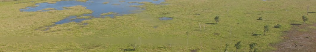
An Object Based Image Analysis (OBIA) approach to Bombana seg - UA-camimage classification groups multiple adjacent pixels into polygon ‘Objects’ based on similar spectral characteristics. This differs from standard image analysis methods that classify each pixel in isolation; the OBIA approach generally produces a cleaner map product,.
Working with Landsat Data:
Terrain Analysis with SAGA GISDEM: View a tutorial showing and example of some terrain analysis (morphmetric) functions with SAGA GIS. This tutorial uses SRTM data for south east Sulawesi but the processing steps will be the same for anywhere.
An Object Based Image Analysis (OBIA) approach to Bombana seg - UA-camimage classification groups multiple adjacent pixels into polygon ‘Objects’ based on similar spectral characteristics. This differs from standard image analysis methods that classify each pixel in isolation; the OBIA approach generally produces a cleaner map product,.
Gamba Fire Sim Demo
This simulation has been designed to illustrate some key principles related to managing fire risk in the Darwin rural zone. It is not a predictive tool but rather a simulation game to help think through management options and implications.The simulation is designed to.
Improve landholder knowledge of bushfire planning and mitigation strategies.
Create a better community understanding of the changing bushfire landscape due to invasive species, such as gamba grass.
go.cdu.edu.au/firesim
Improve landholder knowledge of bushfire planning and mitigation strategies.
Create a better community understanding of the changing bushfire landscape due to invasive species, such as gamba grass.
go.cdu.edu.au/firesim
Переглядів: 818
Відео


2023 Tanamai fire spread animation with fuel age
Переглядів 67Рік тому
2023 Tanamai fire spread animation with fuel age

Spinifex Fire Sim
Переглядів 624Рік тому
These fire games let you practice looking after outstations, cultural places, and important animals in the desert. You can make fire breaks and burn the grass to stop bushfires. You can see how the weather, wind, and more spinifex grass make the fire do different things. You can also see what happens when there is lots of buffel grass. Click on a picture and see if you can stop the fire burning...

Dr Rohan Fisher ABC-Top5 Presentation
Переглядів 43Рік тому
Presenting to ABC staff as part of our Top-5 media residency.

Mapping burnt areas with SAGA-GIS
Переглядів 204Рік тому
A quick screen shot tutorial showing a process for mapping landscape fires with SAGA GIS

Northern Institute presentation June 2022
Переглядів 42Рік тому
Projection Augmented Landscape models. Process and application

Cat and fire sim
Переглядів 672 роки тому
A simulation of the interaction between cats and fire on small mammal predation

Hotspot animation Central NT 2019-2022 October
Переглядів 312 роки тому
Hotspot animation Central NT 2019-2022 October

Landscape knowledge visualisation: Innovations in 4D simulation and gamification of complex systems
Переглядів 2962 роки тому
This seminar describes the use of projection augmented landscape technology to bring spatial data and local knowledge together in a way that facilitates two-way learning about the environment, science, and culture in diverse, cross-cultural, cross-linguistic contexts around the world. The approach uses simulation ‘games’ of landscape processes projected onto 3D printed landscapes. The projectio...
Central Australia 2011 hotspot animation
Переглядів 3,3 тис.3 роки тому
Central Australia 2011 hotspot animation
2020 hotspotanim Top-End
Переглядів 444 роки тому
The 2020 Top-End fire season in 50 seconds. Some of the most fire-prone landscapes in the world. Keep watch on active fires with NAFI. firenorth.org.au/
2020 hotspot animation Kimberley
Переглядів 1004 роки тому
The 2020 Kimberley fire season in 50 seconds. Some of the most fire-prone landscapes in the world. Keep watch on active fires with NAFI. firenorth.org.au/
Projection Augmented Landscape Models
Переглядів 1,9 тис.4 роки тому
Projection Augmented Landscape Models
North Australia Hot Spots 2004 2019 comparison.
Переглядів 2,7 тис.4 роки тому
North Australia Hot Spots 2004 2019 comparison.
North Aust HotSpopts 2004 2019 compare
Переглядів 895 років тому
North Aust HotSpopts 2004 2019 compare
Augmenting physical 3D models with projected information
Переглядів 2205 років тому
Augmenting physical 3D models with projected information
Hacer3D - 3D Printed Landscape Production - Espanol
Переглядів 646 років тому
Hacer3D - 3D Printed Landscape Production - Espanol
Sentinel-2 imagery + hotspots for fire monitoring.
Переглядів 1,3 тис.6 років тому
Sentinel-2 imagery hotspots for fire monitoring.
Sentinel 2 -Mexico Mine Mapping. Espanol
Переглядів 4296 років тому
Sentinel 2 -Mexico Mine Mapping. Espanol
no audio
audio is broken
landscapemodels.net
Apa ini, Om?
landscapemodels.net
This video came resourceful to me after 7years.. Thank you!
Nice
😃👏👏👏👍
smart one!
IT IS GOOD !
Hi! Very nice video! Did you do it in python?
QGIS and Camtasia
this is a good tutorial. dou you have any idea on implementing OBIA for segmenting mineral in petrography? your reply will be appreciated sir, thanks
No I have never tried that.
Hello!! Can you please leave a link for the image data you have used? Thank you!
You can find download links here: sagatutorials.wordpress.com/downloads/
Hi! Great video but why do you change the cell size to 90? I'm working with 30m cell size and mine says 31; should I resample to 30? What would be the benefits?
Good question. When I originally made this tutorial only 3second DEM was available so I resampled to 90 meters
Also at that resolution the process runs quickly on any computer
@@trowertower I need to work with the higher res data (which is supposed to be 30m) Should I resample to 30 if mine says 31? Or can I just leave it as is?
@@MariekjeTheMi - I doesn't matter. It will not significantly change the output.
Can I do accuracy test for this mapping? If yes may i know how? please Thank you
Hi, thank you for this tutorial, anyone knows how to remove black rectangle from dem. after preprocessing -> no sink
how do you know what part is mangrove and what part is other types of vegetation?
Thanks for the tutorial. How to lessen the amount of segment so it can be broadly segmented the object?
Decrease the number of cluster (classes) or increase the band width.
Sort of... more like a cellular automata/geosimulation
How to download data from libra.development.org
Thank you for the excellent tutorial. I wonder, why do you prefer the RGB band combination instead of false-color composite for Mangrove (4811)? Does it make any difference if I use the latter band combination? Thanks in advance.
No it shouldn't make a big difference. Try and see.
sorry to be offtopic but does anybody know a trick to log back into an Instagram account? I was stupid forgot my account password. I love any assistance you can offer me!
@Milan Alfonso Instablaster :)
@Bobby Roman i really appreciate your reply. I found the site on google and Im trying it out atm. I see it takes a while so I will reply here later when my account password hopefully is recovered.
@Bobby Roman It worked and I actually got access to my account again. I'm so happy! Thanks so much, you saved my account :D
what is the unit of the area? answer please
Square Meters
@@trowertower thank you very much
do you have some paper or journal that referenced to this sir?
Man, this is so cool. It is relatively unexpensive and give some practice for the covid pandemic classes.
can i use this step to identify tree species?
Difficult
@@trowertower oke noted, thanks for the reply
How can i correlate NDVI and LST on saga gis?
thnks alot keep it up and i need more on delination system or how to delenate and mapping the sampling area?
ua-cam.com/play/PLptfvVlzX-HXlcmjlPiYddXyrB1QKLWc6.html
hello sir. have you experienced do a processing for mangrove dealienation using ecognition software?
No I prefer SAGA
Terimakasih Pak. Mohon bertanya juga Pak, apakah hasil dari analisis terrainnya bisa di export dalam bentuk nilai pak ?
kalo boleh ini buat apa yak /?
Hey Rohan, now I start to deal with SAGA software for a master degree . can you tell me how I make a layout image as a result.
how do you differentiate between mangrove and any other vegetation so the computer won't confused which mangrove and which is another vegetation? im following your tutorial step by step by the way
Choose a band combination for the classification that works best for picking the mangrove. You may set some classification error that you can edit manually.
I like how you made the fire simulation. I like to try making one myself. Do you have any tutorials to share ?
Not really - but I am using a spatially explicit Agent Based Modelling approach.
I would like to ask - why I receive slightly different results for OBIA by shapes and OBIA by grids? - I defined five training signatures - in "shape version of OBIA" I received an assignment of all segments to my five categories - in "grid version of OBIA" I received six categories - one category contained segments that were not assigned to my signatures - why - is it not same algorithm, method?
I can try to answer. In grid you may have adjacent pixel value while in shape one tries to create precisely boundary. Statistically this would change the result a bit. hope it satisfies.
Please make a video of Landslide Hazard Mapping.
Please if l may ask, what is the essence of image segmentation and how will you get your data to be used in machine learning classification such as svm, random forest etc? Am confused. Any help?
Please make a tutorial of Landslide Hazard Mapping in Saga gis. Thank you
I don't think I am clever enough to do that... :)
nice tutorial.....you can visit my chanel also on this chanel ...ua-cam.com/video/gp9Qr4NtPnw/v-deo.html
Excelente video
🤙
Hola muy bien! ´puedes hacer un ejercicio paso a paso con Sentinel 2? y con Imagenes de Drones?
is there any step before this step in this video?
how to determine the accuracy of Classification Test Results ???
Om, Bisa minta kontaknya?
Kenapa?
Can I connect with you ex. Email address
Can I make a Cluster classification and then run OBIA to calculate the individual area of every cluster? I have ran cluster or SVM clasiffication, and try to calculate surface, but every time I have obtained half the area that really is
hight programme very very nice $$$
how can i get this software? I built the arsandbox and I am trying to raise for learning my pupils. Thanks in advance
Why is there no volume to this, can'rt hear any instructions :(
There is no narration
where can i import the bands 3,6,7?
THANKS